Pierre Jacotin
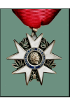
Officer of the Legion of Honor
Pronunciation:

Pierre Jacotin was born in Champigny-les-Langres, Champagne, on April 11, 1765. His father, Etienne Jacotin, was a simple farmer, but after 1770, his maternal uncle, Dominique Testevuide, directed the establishment of the Corsican land register (known as the Plan Terrier de la Corse). It was he who encouraged his nephew to pursue a career as a surveyor.
After studying mathematics, the young man followed his uncle to the Isle of Beauty, where he worked under his direction from 1781 to 1794. Starting out as a student surveyor, he gradually rose through the ranks, becoming a geographer-engineer and then chief surveyor. As Corsica had temporarily fallen under English rule, the French authorities were obliged to provide the invaders with the cadastral map they had just completed, not without obtaining the right to keep a copy. Despite the unwillingness of Admiral Samuel Hood, the head of the English forces, Jacotin completed his copying work and left Corsica in March 1796 with the results of his efforts.
In 1798, still under his uncle's authority, Pierre Jacotin was part of the team of geographers assigned to the Egyptian expedition to map the country. He personally carried out numerous surveys of Alexandria, Cairo and the Syrian Expedition, during which, in the first half of 1799, he walked the route between Cairo and Saint-Jean d'Acre, surveying the army's marches and camps with his feet and compass. On his return from Syria, on June 28, 1799, Napoleon Bonaparte appointed Jacotin chief engineer-geographer of the Army of the East, replacing his uncle Testevuide, who had been assassinated eight months earlier during the great Cairo revolt. This appointment gave Jacotin the rank of colonel.
Regarded as the main author of the map of Egypt, Jacotin was a member of the Commission des Sciences et des Arts from its inception. He then joined the Institut d'Egypte (January 20, 1800) and the Conseil privé de l'Egypte (September 14, 1800), while continuing to work on his map, assisted by another engineer-geographer, Jean-Baptiste Coraboeuf, and two polytechnicians, Edme-François Jomard and Bienheureux Lecesne. Only his marriage to Marie Naydorff on July 7, 1801 interrupted his work for a while.
After the surrender of General Jacques-François de Menou, and informed by his Corsican experience, Jacotin succeeded this time in keeping the results of the engineers' and geographers' work away from the victorious English, who dreamed of seizing it. It was only by dint of care and prudence that the work of the engineers and geographers was saved from the hands of the English
, he later wrote.
Returning to France in December 1801, Jacotin was appointed head of the topographical section of the Dépôt de la Guerre on January 16, 1802, a position he held until his death. He was also appointed professor at the Ecole spéciale militaire de Fontainebleau (March 10, 1803).
Continuing his great work, Pierre Jacotin applied himself to the production of his two maps of Egypt and Syria. The first, a topographical map in 1:100,000 scale, comprises 47 sheets covering a total area of 11 square meters. The second, a geographical map at 1:1,000,000, has just 3 sheets and a surface area of just under one square meter. They were engraved in June 1804, but Napoleon placed them under military secrecy and their publication was forbidden until the Restoration.
The experience acquired in the making of these maps was the subject of an article: Mémoire sur la construction de la carte de l'Egypte, written by Jacotin and included in the Description de l'Egypte. It was also used by the engineers in Jacotin's section in their daily work of drawing up maps of the Empire (and of the various regions traversed in the course of military campaigns), both those working in the Paris offices and those surveying in the field. The result was a considerable reduction in turnaround times (60-80%).
In 1821, Jacotin helped found the Société de Géographie. In record time (less than a year), he supervised the production of a map of Spain, which was used in 1823 during the French intervention. In 1824, he returned to the field of his beginnings to draw up a new map of Corsica, and then undertook the famous 1/80,000-scale staff map of France, which he did not have time to complete.
He died on April 4, 1827, in Paris, at 4 rue du Four-Saint-Germain, of gangrene in the leg, despite the care provided by doctors Dominique Jean Larrey and Dubois, two veterans of the Egyptian expedition. He was buried the next day in the Père Lachaise cemetery, 39th division , in the generals' plot.
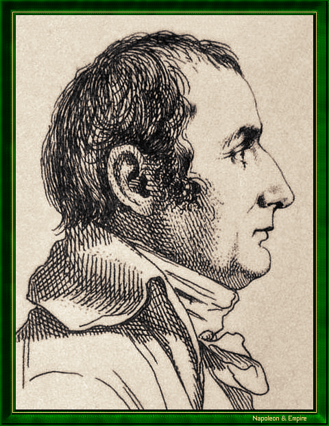
Pierre Jacotin. Anonymous engraving.

Jacotin was awarded the Chevalier de la Légion d'honneur on June 17, 1809. He was promoted to Officer on April 25, 1821. He had also been Chevalier de Saint-Louis since August 13, 1814.
His tomb is adorned with an obelisk, in memory of the importance of his work in Egypt.